
The Psalter World Map of the 13th Century: Unveiling mysteries of the medieval world.
The Psalter World Map, a medieval marvel, intertwines art, faith, and geography, offering a unique window into the medieval worldview.

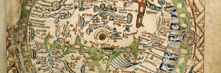
In the heart of the British Library’s collection, amidst a sea of historical documents, lies a small yet extraordinarily intricate masterpiece of medieval cartography: the Psalter World Map. Created around 1265, this map transports us back to a time where geography, faith, and artistry intertwined to form a distinct worldview.
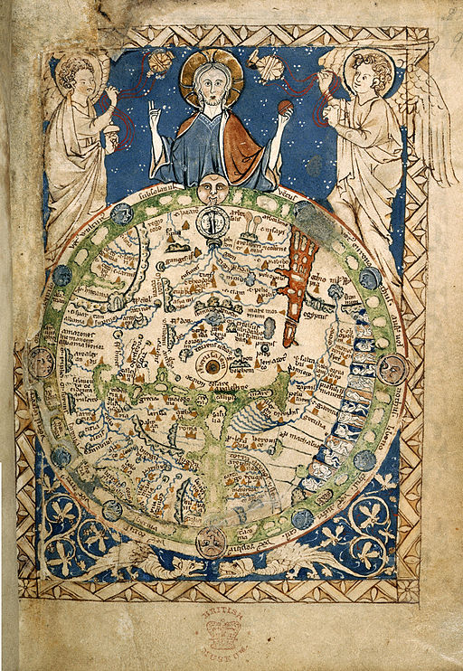
The map spans just 11.6 by 14.5 cm – roughly the size of a modern-day smartphone, but it’s incredible in detail.
The creator of the Psalter World Map is uncertain. Whoever the artist or cartographer was, they did not sign their work, making it challenging to attribute it to a specific individual. The name is derived from the word “Psalter”, a book containing the Book of Psalms.
Unlike most maps, the Psalter World Map has EAST placed at the top, so due NORTH is to the left. In medieval times it was said that East was the most significant direction as it pointed to the Garden of Eden, paradise and the second coming of Christ. The biblical paradise is depicted as a circular walled garden.
At the centre of the map, lies Jerusalem which had theological importance as the spiritual epicenter of the world. Rome is also displayed.
The Psalter Map shows many biblical narratives across the canvas. Zoom in, and you’ll find Noah’s Ark, the Tower of Babel reaching ambitiously upward, and scenes of everyday life.
This remarkable mappa mundi blends faith, art, and space into one. The Psalter Mao is one of the ‘great’ medieval world maps and possibly a copy of the map that adorned King Henry III’s bedchamber in Westminster Palace from the mid-1230s
The four faces in the “corners” of the Psalter World Map are thought to represent the “Four Winds” of medieval Christian culture. The winds known as Boreas (North), Zephyrus (West), Notus (South), and Eurus (East), were often depicted as faces on ancient maps. There are additional faces around the periphery of the disc. The four winds plus eight smaller faces giving twelve in total.
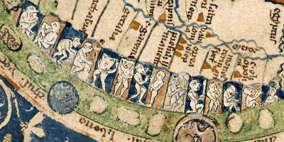
There are also “peoples” of the map including a curious array of humanoids.
We’ve remastered the map a little and restored the top left border (not perfect, but at least it now has a border) and added the left angel’s wings back into the map.
This is available as a digital file (300 DPI) for you to print yourself or as a poster/print that will be delivered to your door.
The Psalter World Map, a medieval marvel, intertwines art, faith, and geography, offering a unique window into the medieval worldview.
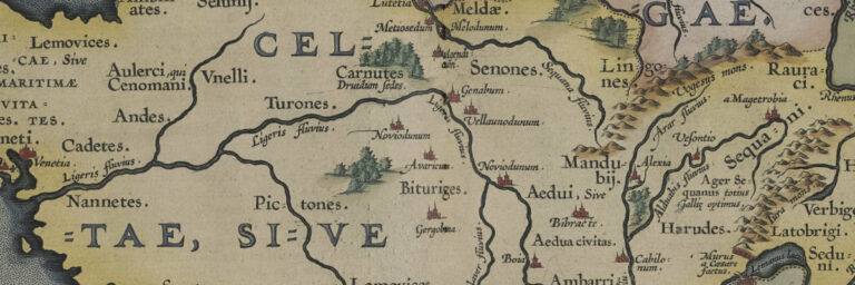
The Gallia Vetvs 1590 map is a historical masterpiece that depicts the ancient region of Gaul, which is now modern-day France. The map was created
Checking out Castles in Wales – a review of all the castles including ancient ruins with descriptions, prints and maps.